Thursday, December 19, 2013

Recommended reading: Nevada City and architectural theory

Back in September, this piece was posted over at Uncouth Reflections. The writer calls the gold rush town of Nevada City, California, an "architecture-and-urbanism masterpiece" and uses photos from his trip there to develop some "hunches" about architecture and urban design in general:

"Some more hunches about what might result in humane and pleasing built environments: Approach building and development as an outgrowth and refinement of nature. Work with the actual environment, not against it. Make generous use of local materials. Value pluralism and variety, yes, but value harmony and simple, direct human pleasures even more. Perhaps, 99% of the time, fitting in is more important than standing out. Value the roughshod, the approachable, the informal and the ramshackle more than the impersonal, the awe-inspiring and the perfect." 

I recommend reading through the entire article; it is full of great photos as well as urbanism common sense.

Friday, December 6, 2013

"Union Way" in Portland, Oregon

Union Way is a very cool little project that opened this past summer in Portland. It feels like and functions as an outdoor pedestrian street, when in fact it actually cuts down the spine of a massive old garage building. One of Union Way's developers noted that the project "takes its inspiration from small shop-lined alleys and passageways of old in cities like Paris and Tokyo." Here's an interesting short article about the "arcade-like space" I stumbled upon this evening. A snippet:
“Essentially the Red Cap Garage is this long, deep, narrow building. It’s 47 feet wide and about 135 feet deep. The problem that you have is that only 47 feet has street frontage. So this space deep in here begins to be dark. The question becomes: how do you monetize that? How do you make that valuable? How do you make that interesting? The answer was to add a new street.”
Union Way (photo by Jeremy Bittermann)

Tuesday, December 3, 2013

The city from the air

Some modern city planners have been jokingly criticized for designing urban spaces in a way that the city is visually appealing from an airplane.

Okay, maybe only half-jokingly. Heck, Brasília was planned to look like an airplane from an airplane;

Tuesday, November 26, 2013

True sustainability

UniverCity is a sustainable-development community located at the top of Burnaby Mountain (adjacent to Simon Fraser University) outside of Vancouver. Here is what the area looks like from above:


View Larger Map

Two things are apparent from the satellite view: an abundance of green space, and an abundance of parking space.

Monday, November 18, 2013

The German town that scrapped all traffic lights and signs

Excellent little story (complete with pictures) on the success of "shared space" in Bohmte, Germany. 

Here's a snippet:

"Four weeks ago, Bohmte banned traffic lights and warning signs, including those instructing drivers to give way or stop.
Only two rules remain – drivers cannot go above 30 mph, the German speed limit for city driving, and everyone has to yield to the right, regardless of whether it is a car, a bike or a mother with a pushchair.
Officials revealed there have been no shunts, bumps or pedestrian injuries in the month since the scheme started.
Previously, there was at least one serious crash every week and scores of lesser 'fender-benders'."
Read more: http://www.dailymail.co.uk/news/article-1028740/Accident-free-zone-The-German-town-scrapped-traffic-lights-road-signs.html#ixzz2l33llJaD 

Friday, November 15, 2013

Continental differences in street pattern

Dave Munson over at Munson's City recently did a cool study comparing the most common street grids from continent to continent. He used three common categories: Grid, Organic, and Loose Grid. Munson writes:

"When I was two years old, my family moved from the Bay Area to Northampton, Massachusetts. My earliest memories are from there and it is one of the three or four places I usually claim as my hometown.
My family loved Northampton, and even after moving away, we would make regular pilgrimages back every few summers or so. I really wasn’t sure what I liked so much about it until I went to urban design school, but now I know part of it was the organic street grid. Each block feels distinct, and the slight curves of the streets create outdoor rooms, while the density of the street network allows multiple ways to get to your destination.
Unfortunately, the organic street system, common in other parts of the world, is a rare thing in the US and Canada. I decided to take a look at the major cities of Anglo-America and see where I could find organic cities. But first, here are the general characteristics of the street patterns I found..."

Check it out!

Saturday, November 2, 2013

Taxco, Guerrero

The relatively hidden gem of Taxco lies approximately 100 miles southwest of Mexico City. The town is known for its silver trade and irregular, winding streets.

The beautiful church of Santa Prisca is in the center of town. And, for the record, you are looking at pretty much the widest stretch of pavement in the city.


View Larger Map

Thursday, October 31, 2013

Ciudad tradicional: Colorful Campeche, Mexico

Campeche was founded in 1540 at the site of an ancient Mayan city named Kimpech. Its location on the Gulf of Mexico made it susceptible to pirate attacks, so a fort and defensive wall were constructed. Much of the original wall remains, and the city within the walls is listed as a World Heritage Site.

This is what the historic section of the city looks like from above. Notice the regular grid plan.


View Larger Map

We'll start off at the square you see in the upper part of the picture.

Tuesday, October 29, 2013

Ciudad tradicional: A Look at San Luis Potosí

Mexico, unlike its neighbors to the north, is filled to the brim with traditional-style cities. Most of these cities were founded during the brutal Spanish conquest, but some pre-Columbian sites remain from previous inhabitants. This is the first post in a series showing some of the wonderful pre-automobile towns that Mexico has to offer.

San Luis Potosí was founded in 1592 by miners. The city was named after the famous mining town of Potosí in modern-day Bolivia. SLP's center is home to some of the finest colonial architecture in all of Mexico.
For example...


View Larger Map

Friday, October 18, 2013

The allure of by-lanes & cobbled streets

This is an awesome page I stumbled upon today. Scroll through the pictures for a while.

Cunda, Turkey

This is what I mean by "traditional" urbanism! Life without cars is beautiful.

Wednesday, September 25, 2013

A Brief Tour of Wilmington, N.C.'s Historic Water Street

Recently I enjoyed a short visit to the oldest section of Wilmington, NC: Water Street. Wilmington was founded in the 1730s and Water Street is the best remaining memory of the town's original pre-automobile and people-focused layout. 


Here is a portion of the architecturally-lovely Alton Lennon Federal Building at the corner of Water and Market. At this point, Water Street is about 20-25 feet wide, paved in brick, and quite pedestrian-friendly.


This picture was taken from where the riverfront boardwalk meets the sidewalk in a plaza-like space. The tree-lined street with the parked cars is Market. The public art is a couple of giant Venus flytraps, I think. The river itself is less than ninety feet away from that (gorgeous) blue building, to give an idea of how close to the water Water Street really is.


The brick part of the street narrows to about 13 feet as you walk southward. From what I saw, most cars tried to avoid this section of the street. The speed limit, I would guess, is about 10 mph. Walking in the middle of the street was quite comfortable with traffic being so limited, but most people stuck to the ample sidewalk space. The building to the left (built in 1857) is a popular restaurant.


Looking back to where we started. (I'm also just a huge fan of those two buildings!)


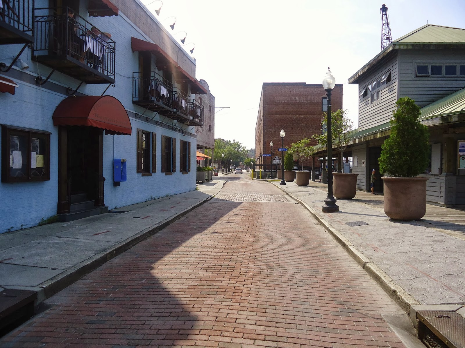
A bit further down the street.


By this point, the riverfront boardwalk is separated from Water Street by buildings. Most of the foot-traffic (i.e. tourists) stuck to the boardwalk. Very little car traffic...


...until this tour bus drove by (although "crawled by" would be more accurate.) Why someone would rather drive than walk down this street, I have no idea. Also, a neat little pocket park is to the right.

Overall, Water Street is easily the nicest-looking and most walkable section of Wilmington. It seemed a bit lacking in the people department (most stayed closer to the river) but I visited at noon on a weekday so maybe it gets hopping at nighttime. This street is definitely one of North Carolina's best.
---
Here is a map of the area (click to enlarge) from Google Earth with the approximate locations of where the pictures were taken. The distance from picture 1 to picture 6 is less than a quarter of a mile.


Tuesday, September 17, 2013

New Orleans has a radical new plan for managing floods

An intriguing plan for New Orleans and its flood problems. (Unfortunately, money is obviously going to be an issue.) Rather than attempting to stop the water's advancement, the plan would try to control the flood and use it to the city's advantage.

Here's a snippet of the article:
"...[U]nder the Greater New Orleans Urban Water Plan, floodwaters would be corralled into areas that serve as parks during drier times. Rain gardens and bioswales would help the earth suck up more of the rain that falls on it. And water would be funneled into year-round canals and ponds that support wildlife, improve soil quality, and generally pretty up the place."
Source: grist.org

Wednesday, September 11, 2013

2 American Alleyways Repurposed as Narrow Streets

Tight streets (or "Really Narrow Streets" as Nathan Lewis calls them) are KEY in any successful urban area from the smallest village to a Tokyo-size megalopolis. I would say they are the most important part of what makes a great city (a city for people, not cars). Unfortunately, American cities have a noticeable lack of them outside of places founded in the colonial era like Boston and New Orleans. However, there are numerous examples of American cities sprucing up their alleyways, and the finished result is very similar to a Really Narrow Street. Here are two of those examples.

1. Will Dodge Way, Ashland, Oregon


View Larger Map

Will Dodge Way runs on the backside of the streetwall of buildings on East Main Street in Ashland. The width between each side of the alley (building-to-building) varies from ~15-25 feet.

2. Pedestrian Alley, Holland, Michigan (photo by me)


Google Earth says that this charming spot is called "Pedestrian Alley." Kind of generic, but it does a good job of describing what I would call a narrow street. The alleyway runs between two of Holland's major downtown streets, Central and River, and behind buildings facing the always-popular 8th Street. Several businesses have entrances opening onto the alley. Most of the actual pedestrian traffic sticks to the 8th Street-facing side, though. The width of the pictured section of the alley is about ~16 feet.

Now of course an alley like this is just a tiny pedestrian oasis in what is still a car-focused town... but I thought it would be cool to point out a couple of people-sized spaces that have been developed recently.

Related links:
Here's a Curbed article on a similar plan in a fashionable neighbourhood of San Francisco.

Monday, September 9, 2013

Welcome to Apex Urbanism!

Welcome. My plan for this blog is not really structured- I'll post pictures, articles, etc. related to urbanism that I find interesting. Occasionally I will post original articles of my own about urbanity in my hometown and other places I encounter in my travels.

The kinds of topics that will be posted about on this blog include (but are not limited to):

Cities (this one should be pretty obvious.)
Transportation
Walking as a means of transportation
Buildings & architecture
Traditional cities vs. modern cities

Enjoy!